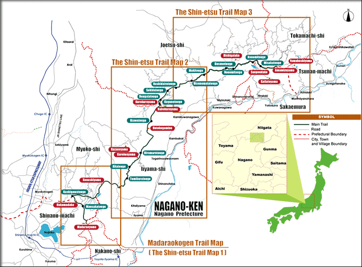
■Map

Divided into three sections, the Shin-etsu Trail Map is a useful tool for hiking. Based on 1:25,000 topographical maps published by the Geographical Survey Institute, the trail map contains plenty of hiking, cultural, environmental, and historical information. It is a must for better understanding and enjoyment of the Shin-etsu Trail. Contact us directly or obtain one at any of the visitor centers. But I'm afraid, maps are published only in Japanese.