- Home
- Hiking the Shin-etsu Trail
Hiking the Shin-etsu TrailHow to hike
Hiking the Shin-etsu Trail
01. Making your plan
When to go?
The Shin-etsu area, home to the Trail, is one of the snowiest places on Earth. You can plan on there being no snow on the ground, and little chance of snowfall, from mid- to late-June to early November.
While there is still snow remaining on sections of the Trail in May and June, this is a beautiful time to travel, with the new green buds standing out against the snow, but you will need to know how to use snow mountaineering equipment such as crampons, as well as good skills in route finding—signs and markers may be under the snow!
Snowfall is possible even in early November; access roads to the passes most often will be closed during the winter months.
Note that Section 10, including Mt. Naeba, has a much shorter snow-free season. Snowfall can occur from late September, and snow can remain on the ground into early July. Be especially careful to check on coming weather and current snowpack conditions before traveling across Section 10.
Depending on the season, you’ll have a very different experience on the Trail. Early summer is the time of new green shoots; autumn of the brilliant colors of the forest. There is the real thrill of doing a through-hike, making use of the accommodations or tent sites along the route. At the same time, you might want to hike two or three times, taking in the different seasons and the very different feeling you’ll experience.
There are some things to be aware and careful of during your hike, so be sure to check out the FAQ section for more detailed information.
How far to hike each day?
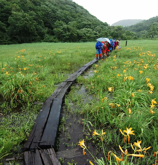
The Shin-etsu Trail is set up so that one day’s hike covers one section of the route. The distance of each is about 10 to 12 kilometers, a distance most people cover in six to seven hours. This makes use of the Shin-etsu Trail member accommodations very convenient. Others may enjoy using the sub-routes found along the Trail that take in the highlights of the sections, for shorter treks of five to six kilometers.
Through-hikers who are staying in tents along the way average eight nights and nine days on the Trail. This means a hike of about 15 to 20 kilometers daily, depending on the section. If you are staying in a tent but are only hiking one section at a time, there is easy access from the passes along the way—enjoy a leisurely hike and stay this way!
02. Equipment and preparation
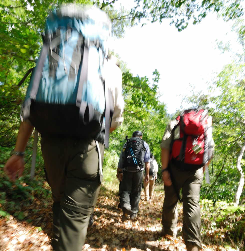
It’s a good idea to think of the hikes along the Shin-etsu Trail as you would any mountaineering adventure: the Trail runs at an altitude of some 1,000 meters through beech forests, the satoyama areas where forest and human settlement intermingle, and even Alpine sections at altitudes above 2,000 meters. The Trail has sections of continuous ups and downs, some with steep slopes and large changes in altitude. There are sections along unpaved roads, and quite a long section on paved roadways. All of this means that it’s critical that you make good planning and have the proper equipment before taking on the trek.
- Always carry the official Shin-etsu Trail Map with you
Have it in a place so that you can bring it out right away. Keep track of your current location by compass and signposts along the way.
The map can be purchased at the area visitor centers, or via the Shin-etsu Trail web store (links below)
- Visitors centers
- Shin-etsu Trail webstore - Gather information in advance, and make a good plan!
Get together as much information as possible, including the latest trail information, weather data, extended forecast, the existence (or absence) or warnings along the Trail and into the populated areas. Then make a reasonable plan—don’t overestimate your own physical strength and skills—and submit a hiking/climbing report to the local authorities before you go.
- News and topics
- Hiking/climbing report - Prepare the right equipment
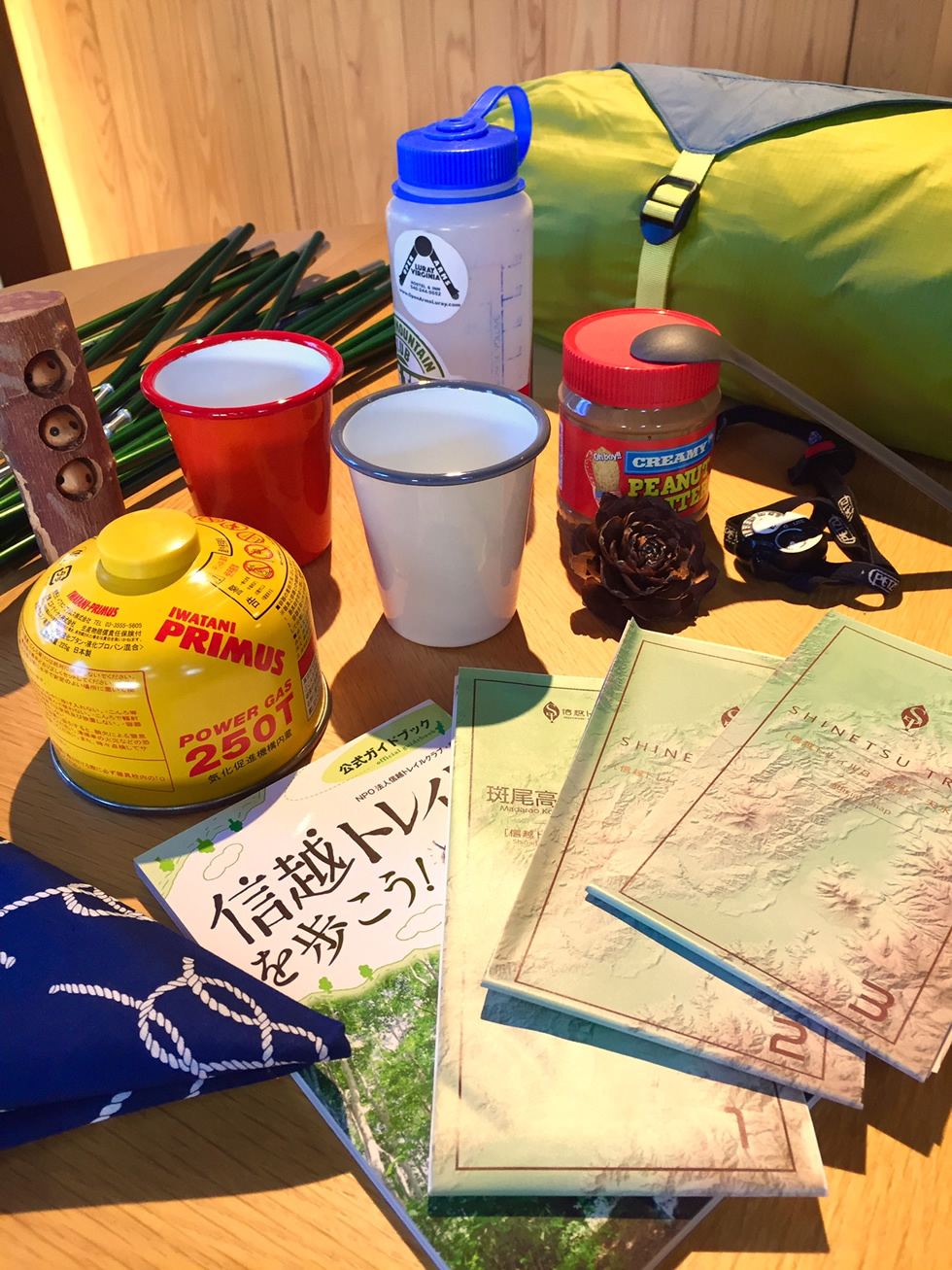
Take a look at the list of things needed to hike the Shin-etsu Trail . Go over it before you leave to make sure you’re all set with the essential equipment. Even if the weather looks to be fine, or you’re just heading out for one day, be sure to have all this equipment with you.
The Shin’etsu Shizenkyo Activity Center, located on the first floor of Iiyama Station, provides rental and sales of many of the items needed to hike the whole of the Trail.
- Shin’etsu Shizenkyo Activity Center
- Items needed to hike the Shin-etsu Trail
03. Hiking/climbing report
The Shin-Etsu Trail Club recommends that anyone planning to hike the Trail should submit a hiking/climbing plan to the authorities.
By reviewing the hiking/climbing plan you have created, you’ll have a better understanding of whether or not your plan is in fact reasonable, and what things you‘ll need to prepare in advance.
In Nagano Prefecture, it is a requirement for anyone passing through designated mountain trails to submit a hiking/climbing plan.
Please pick up a form and return to one of the following (sites are in Japanese only):
- Nagano Prefecture official website: https://www.pref.nagano.lg.jp/kankoki/tozanjorei/tozanjorei.html
- Compass, an online mountain and nature network: https://www.mt-compass.com/reportmenu.php
04. Animals and the environment
Rain
The majority of the Shin’etsu Trail lies at altitudes below the Alpine zone, and the summers can be both hot and humid. To avoid heat exhaustion or heat stroke, be sure to drink plenty of water, preferable with a salt supplement. During the hottest periods, slow down and take frequent breaks in the shade. If you begin to feel the effects of the heat (dizziness, nausea, lack of concentration, fatigue), find a cool, shaded spot, drink plenty of fluids, with salt supplements if possible, cool your body and rest. If symptoms do not improve, call the emergency number (119) quickly. It may take some time for the emergency services to find a translator, so speak slowly and carefully—and don’t hesitate to call if you aren’t feeling well.
Heat
The majority of the Shin’etsu Trail lies at altitudes below the Alpine zone, and the summers can be both hot and humid. To avoid heat exhaustion or heat stroke, be sure to drink plenty of water, preferable with a salt supplement. During the hottest periods, slow down and take frequent breaks in the shade. If you begin to feel the effects of the heat (dizziness, nausea, lack of concentration, fatigue), find a cool, shaded spot, drink plenty of fluids, with salt supplements if possible, cool your body and rest. If symptoms do not improve, call the emergency number (119) quickly. It may take some time for the emergency services to find a translator, so speak slowly and carefully—and don’t hesitate to call if you aren’t feeling well.
Snow
The Sekida Mountain range, through which sections 1 through 7 run, can see snowfall from mid-October at the earliest, with one-day depths of 30 cm or more. In section 10, including Mt. Naeba, snow falls from late September, with snow remaining on the ground until early July. Check the long-term weather forecast; if a cold front or cold winds from the north are expected, make sure that you have the proper gear for cold and snow, and be prepared to turn around or seek lower areas if the weather turns especially bad.
Dangerous animals and plants
Bees, hornets and wasps
A number of bee and wasp species inhabit the whole of the Shin-etsu Trail area, including jibachi, ground-nesting hornets, and suzumebachi, large wasps. The hornets are not as aggressive as wasps, nor is their venom as toxic, but they tend to nest in hidden areas in the ground or in tree hollows, so your presence may cause them to attack without your being aware of their presence. Suzumebachi are highly aggressive and have the most toxic venom of any bee or wasp in Japan (causing them recently to be given the somewhat hyperbolic name of “murder wasps” in the US and elsewhere), so special care must be taken when encountering them on the Trail. When you encounter a wasp in flight, stand still and let it move on; they are triggered by sudden motion. Any sting can be fatal if the victim responds to the venom and goes into anaphylactic shock. If you exhibit any unusual symptoms after being stung, such as increased heart rate, dizziness, numbness, swelling of the lips or tongue, immediately dial 119, provide your location, and, if possible, get to the hospital as quickly as possible. It may take some ambulance to arrive, so if possible (and especially if a Japanese-speaker is available), contact one of the Japan Poison Information Centers for more information on how to respond.
- Japan Poison Information Center Osaka (072)727-2499 (open 24 hours daily)
- Japan Poison Information Center Tsukuba (029) 852-9999 (open 9 am to 9 pm)
Snakes
The Shin-etsu Trail area is home to two highly poisonous snakes, the mamushi (Japanese pit viper, Gloydius blomhoffii) and yamakagashi (tiger keelback, Rhabdophis tirinus). The yamakagashi is a colubrid, meaning its teeth are at the back of its mouth, and it will most often make defensive moves rather than strike forward. The mamushi has more potent venom and is a more aggressive snake. It is common to see both species warming themselves on or along the trail, particularly on sunny days after rainfall. If you do encounter either snake, hold still and wait for the snake to leave. If bitten, it may take some ambulance to arrive, so if possible (and especially if a Japanese-speaker is available), contact one of the Japan Poison Information Centers for more information on how to respond.
- Japan Poison Information Center Osaka (072)727-2499 (open 24 hours daily)
- Japan Poison Information Center Tsukuba (029) 852-9999 (open 9 am to 9 pm)
Ticks
These arachnids, roughly 5 millimeters in length, live in the forest and feed on the blood of animals and humans. If you do find a tick attached to your body, please go to the hospital to have it removed; forcible removal by tweezers can cause inflammation and infection, which in severe cases can be fatal. We recommend that hikers wear full-length trousers and long-sleeve shirts to guard against ticks.
Urushi
Also known as the lacquer tree, urushi is notable for its red branches and compound leaves that spread out radially from the ends of the branches. Touching the tree can cause an allergic reaction for many people, with severe itching and a red rash or blisters forming on the skin. If you do exhibit these symptoms after walking through areas with bushes or small trees, wash the area thoroughly with soap and water and contact a pharmacy for a topical treatment. If the symptoms are severe, visit a local hospital.
05. Arranging your travel for hiking
The Shin-etsu Trail stretches 110 km along the border between Nagano and Niigata Prefectures and the areas that the Trail runs through include rural ranges without public transportation - which means you need to arrange your transportation from hotels/inns to the trailheads (vice versa) by yourself. However, many accommodations in the areas are operated by residents who cannot speak English so you may face difficulty communicating with them on the phone or via e-mail. Additionally, you have to call each taxi company in the area of their responsibility for making taxi reservations; at least 5 (or more) companies to cover entire the Trail. If you are motivated enough to arrange local traveling and lodging before starting your hike, yes, you can go for it!
If you would like to make your travel much easier and more convenient, please consider asking the travel agencies; they hold various tours which are hiker-friendly and fulfilled with hospitality every year so the Shin-etsu Trail Club recommend you to join them!