- Home
- Shin-etsu Trail Stories
- #6: Report on route extension A look at the new 40-kilometer section
Shin-etsu Trail Stories
Through beech forest to a vast cattle pasture
A leisurely, happy morning on the Trail
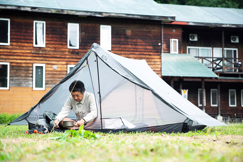
Day three, and I wake up in the middle of the former school playground. It was a sunny morning, the best weather so far on the trip. I boiled some water, brewed coffee, and enjoyed the morning.
Noriyoshi Kato always said, the longer the trail, the better. The longer the distance, the more you feel a connection not just with nature but also culture, history and the local people. A really felt this strongly and deeply as I walked this new extension of the Shin-etsu Trail.
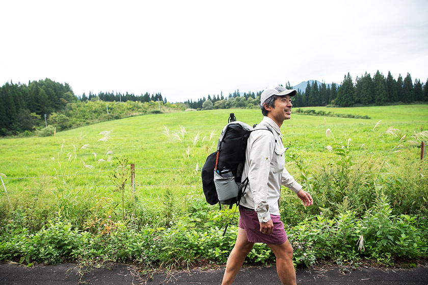
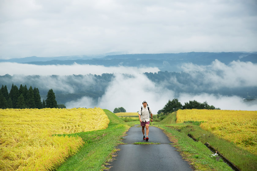
Today, I head north from Kettō village, travelling through a cattle pastureland and the countryside and on to Mori-Miyanohara Station. What will I encounter today?
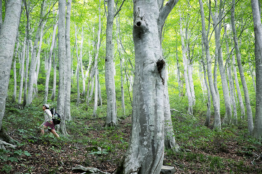
Azukizaka, covered by beech forest
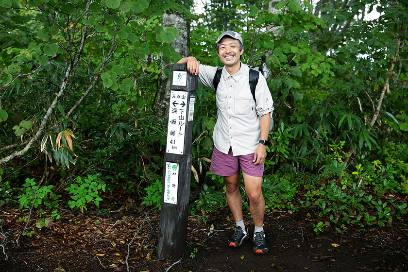
Leaving Katakuri no Yado, a zigzagging climb begins.。
The name of this section is now Azukizaka, but it used to be known as Todo no Michi. Todo means “where you have climbed,” and in the deep canyon of Akiyama-gō, there are many places with the Todo name.
The beech forest of Azukizaka in Kettō is very beautiful. Azukizaka got its name because the time it took to go from the top of the slope (zaka) down to the village was exactly the time it would take to boil azuki beans.
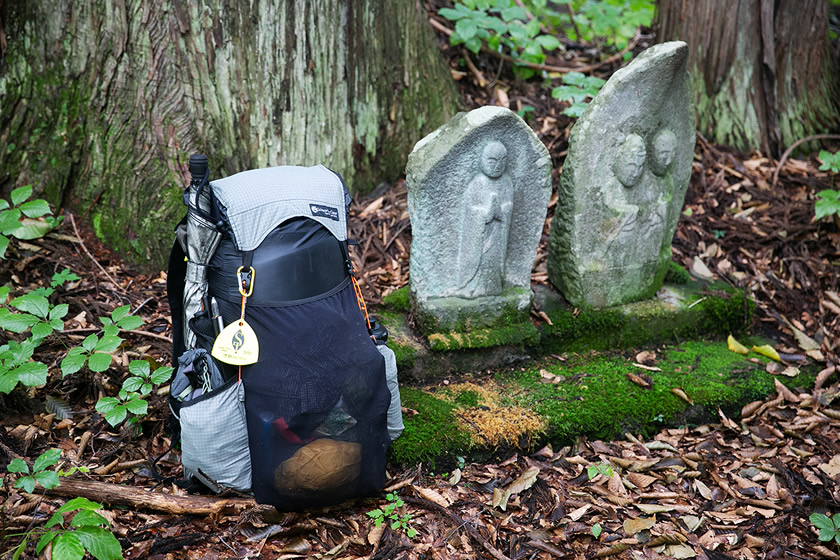
Jizō stone Buddhas at the end of Azukizaka seem to be watching over travelers on the Trail
Leaving the beech forest, I entered a vast pastureland area. This is the Myōhō pastureland/rearing farm operated by Niigata Prefecture. This is completely different from any of the scenery seen so far, with meadows stretching out as far as the eye can see.
The pastureland stretches over a vast area. It’s a bit tiring walking on the paved road, but there’s a wonderful feeling of openness
Meeting a grandmother in her 90s and a primary school student in Nakago village
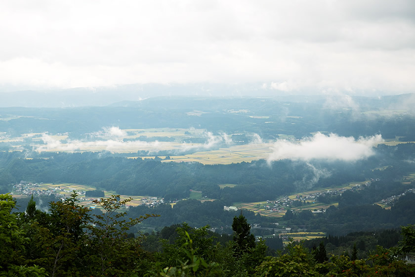
After walking for about two and a half hours, the village of Nakago comes into view below. This is a great view, created by special stair-like terrain called fluvial terraces.
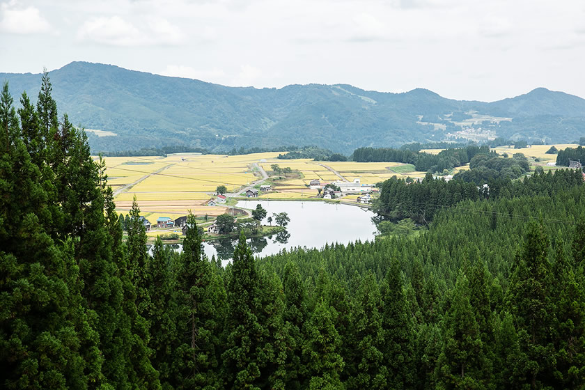
Nakago Village, seen from high up. This overlook is from a unique structure called a fluvial terrace
The Naeba mountains should be designated as a geopark because of the unique topographical features found here. The area I walked on that day was lava formed by the eruptions of Mt. Naeba and Mt. Torikabuto.
Many archeological sites from the Jomon Period (14,000 to 300 BCE) have been excavated here, making it interesting as a place where nature and people have coexisted for a very long time.
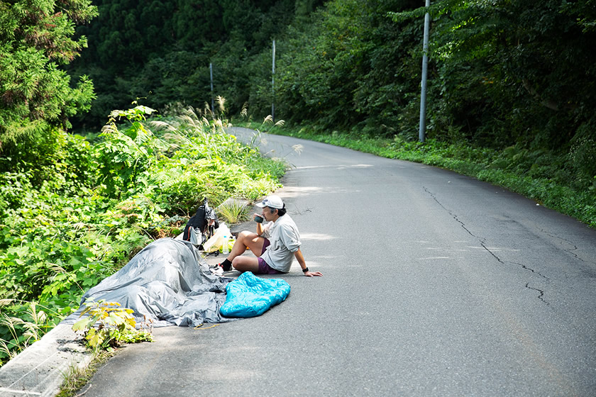
Taking a break while looking over Nakago Village, and drying out a tent wet from overnight dew
After entering and walking through Nakago Village, I came across an older woman talking with some girls.
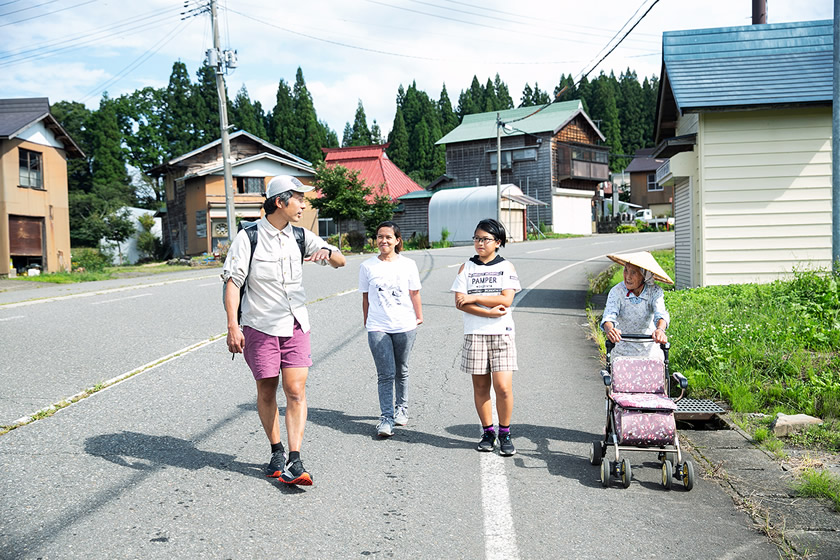
Interacting with locals is one of the attractions of long-distance hiking
When I asked them about places I should see in Nakago, they told me that Nakago no Ike (pond) was close by, and that they would guide me. The older woman told me that she was born and raised here and was now in her 90s. One girl who provided lots of information on the area was a sixth grader, and one of the older women’s relatives.
The three left me at the pond, and I stood for a while looking at it. It was built to provide irrigation to the rice fields in Nakago. Today it is known as a famous spot for viewing the cherry blossoms, and apparently becomes crowded with camera-toting visitors in spring.
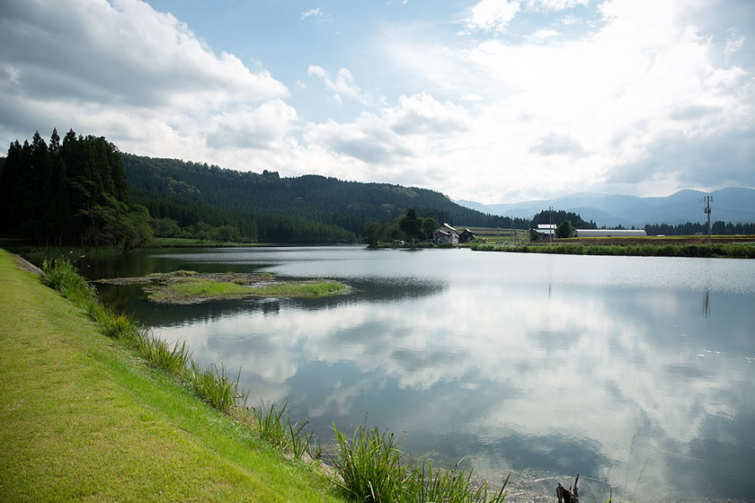
Nakago no Ike pond, famous for its cherry blossoms
Walking in rice fields during the harvest season
All around the Nakago no Ike were rice fields, ready for harvest. The sight of the golden heads of rice kernels was beautiful, and it was pleasant to walk along the fields.
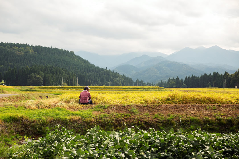
Walking while enjoying the view of the golden fields of rice
Then, when I turned around, I saw the summit of Mt. Naeba in the distance, the starting point of my first day. I felt as though the mountain was watching over me as I continued down the Trail.
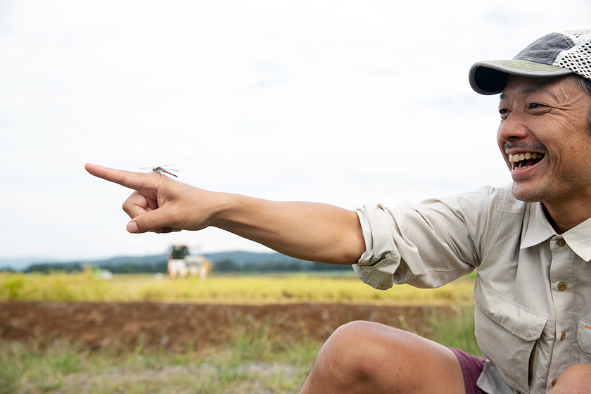
Dragonflies were flying everywhere, so I played with them a bit
After pasting through the countryside and exiting onto National Highway 117, I found Fugetsudo, a confectionary shop. The timing was perfect, I thought, because I wanted to buy some snack for the Trail, and I entered the shop.
The woman in the shop seemed a little surprised by the backpack I was carrying, but welcomed me with a smile. In wondered if I seemed a bit suspicious, but I explained that I had hiked there from Mt. Naeba. She was even more surprised, but seemed to understand and responded very kindly.
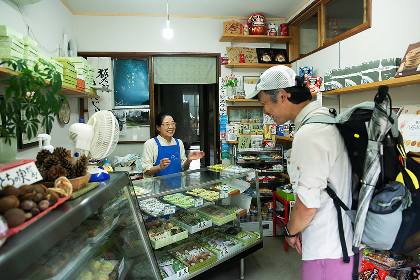
A chance encounter with the Japanese confectionary shop Fugendo, on National Highway 117
The shop owner told me that she was married here at 19, and had been in business here for 60 years. She sells yokan (a sweet jelly made from beans), she said, but her daughter also handles bread and backed goods, so I bought both yokan and baked items.
My accommodation for the night was at the Echigo Tsumari Kamigo Clove Theatre, created by renovation what was Kamigo Junior High School in 2015. This is also one of the centers for the Echigo-Tsumari Art Triennial. Normally it doesn’t accommodate hikers, but I was able to get special permission.
The goal: passing through the wonderful beech forest, and to the Mt. Amamizu summit
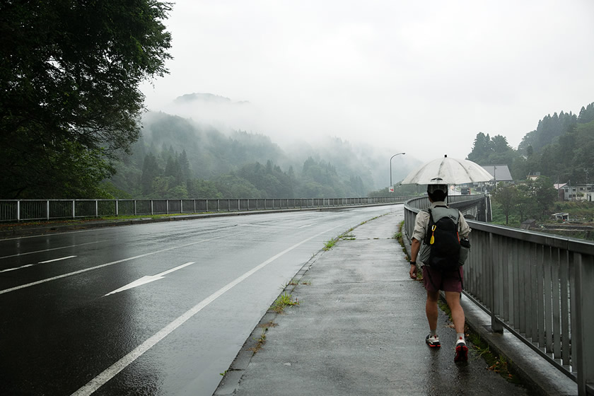
Starting for Mt. Amamizu in the rain, on a bridge over the Shinano River
The final day means traveling to where we will meet up with the existing Shin-etsu Trail. The goal is the summit of Mt. Amamizu.
Unfortunately, it continued to rain from early morning. The forecast was that it would gradually clear up, so I had thought of waiting for a while, but decided to go.
It had rained on the first and second day, but it has still been fun. So I thought, I didn’t need to wait for the rain to stop.
An enjoyable walk down a farm road, but feeling a little lonely that this would be the last day
After passing Mori-Miyanohara Station, it was a continuous climb all the way to the Mt. Amamizu summit. I had thought it would be pretty hard, but perhaps my body had gotten stronger after three days of walking? I was able to keep on walking at a pretty good pace.
Along the section of farm road before I entered the Trail, there were fields of golden rice on both the left and right, while in the background a sea of clouds covered the mountains. It felt good to be in an ideal location. A journey that had started at Mt. Naeba, along a Trail linking the villages of Akiyama-gō at the foot of the mountains, through pasturelands and countryside would now head back into the mountains.
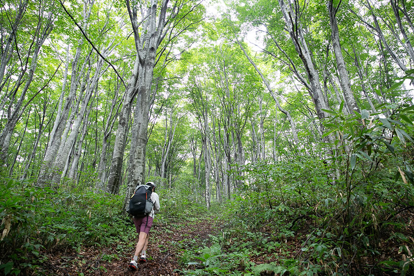
The beech forest, synonymous with the Shin-etsu Trail
Entering the path, it’s truly the Shin-etsu Trail, with beautiful and fresh beech forest—it’s a healing place.
I was in a hiker’s condition not unlike a runner’s high, and continuing to walk with a sense of innocence, I suddenly realized that I had reached the summit of Mt. Amamizu.
Scenery on the way to Mt. Amamizu, including fluvial terraces in the distance
I had finally completed the new section of the Shin-etsu Trail. It had only taken four days, but so many things had happened that I couldn’t at first remember each day.
Descending Mt. Naeba and entering Akiyama-gō, I was able to sample the foods and the culture nurtured in this area; passing over trails and paved roads we went through the villages of Akiyama-gō. From mountain to village; from village to mountain.
If it were possible, I would turn back from the summit of Mt. Amamizu and walk the four days back to Mt. Naeba again. But instead, after climbing Mt. Amamizu, I descended to the Matsunoyama trailhead, then stopped in Matsunoyama Onsen where I stayed the night And that was good, too!
At the end, finishing the climb of Mt. Amamizu, and concluding the traverse of the new section of the Shin-etsu Trail
トレイルカルチャーを発信するウェブマガジン。
TRAILS(トレイルズ)はトレイルで遊ぶことに魅せられた人々の集まり。トレイルに通い詰めるハイカーやランナーたち、エキサイティングなアウトドアショップやギアメーカーたちなど、最前線でトレイルシーンをひっぱるTRAILSたちが執筆、参画する日本初のトレイルカルチャー・ウェブマガジン。
有名無名を問わず世界中のTRAILSたちと編集部がコンタクトをとり、旅のモチベーションとなるトリップレポートやヒントとなるギアレビューなど、独自の切り口で発信。
https://thetrailsmag.com
INDEX
- #01: Noriyoshi Kato InterviewEncounter the miracle on the Trail
- #02: Creating a long trailThe story behind the birth of the Shin-etsu Trail
- #03 Volunteers continue to protect the TrailHow to build and maintain a long trail
- #4 A long trail created by local peopleWorking to create a trail loved by locals
- #5 The life of Noriyoshi KatoA rebellious spirit, and a hope for long trails
- #6: Report on route extensionA look at the new 40-kilometer section